This summer I interned at the Iowa DOT and did some pretty awesome things.
- Learned GeoMedia and Worked with Oracle Databases
- Worked with ArcGIS Server
- I designed & helped to deploy a new external ArcGIS server architecture (anonymous & authenticated portals)
- Updated Publishing Standards
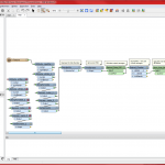
- Designed FME Workflows and published them to FME Server
- Parsing 511 events data from XML feeds, filter, and stylize into a KML
- Combine multiple Oracle views into a National Bridge Index table and REST service
- Designed Multi-state 511 Events/Road Conditions Map
- Parsed 511 event data for CARS states and Nebraska using an FME process
- Pulled data from other states
- Worked with Iowa’s 511 Program Engineer to stylize events and format popups of all states in a similar manner
- Managed Iowa DOT’s AGOL Site
- Developed Publishing Standards
- Managed Iowa DOT’s GIS Website
- Other GIS Projects
One of the most powerful pieces of software that I used was a program called FME. It can be used for so many things. The Iowa DOT uses an FME process to share plow images and DOT locations.


The most powerful use I found for it was to parse 511 event data from Castle Rock‘s CARS 511 XML feeds using xfMap, then filter the feed based on certain attributes. The record is then stylized and given a custom pop-up, before being written to a KML file. I also added a transformer in that will send an email alert with info about records that didn’t match any filters and were dropped to the program engineer and the GIS team, to resolve the dropped records.